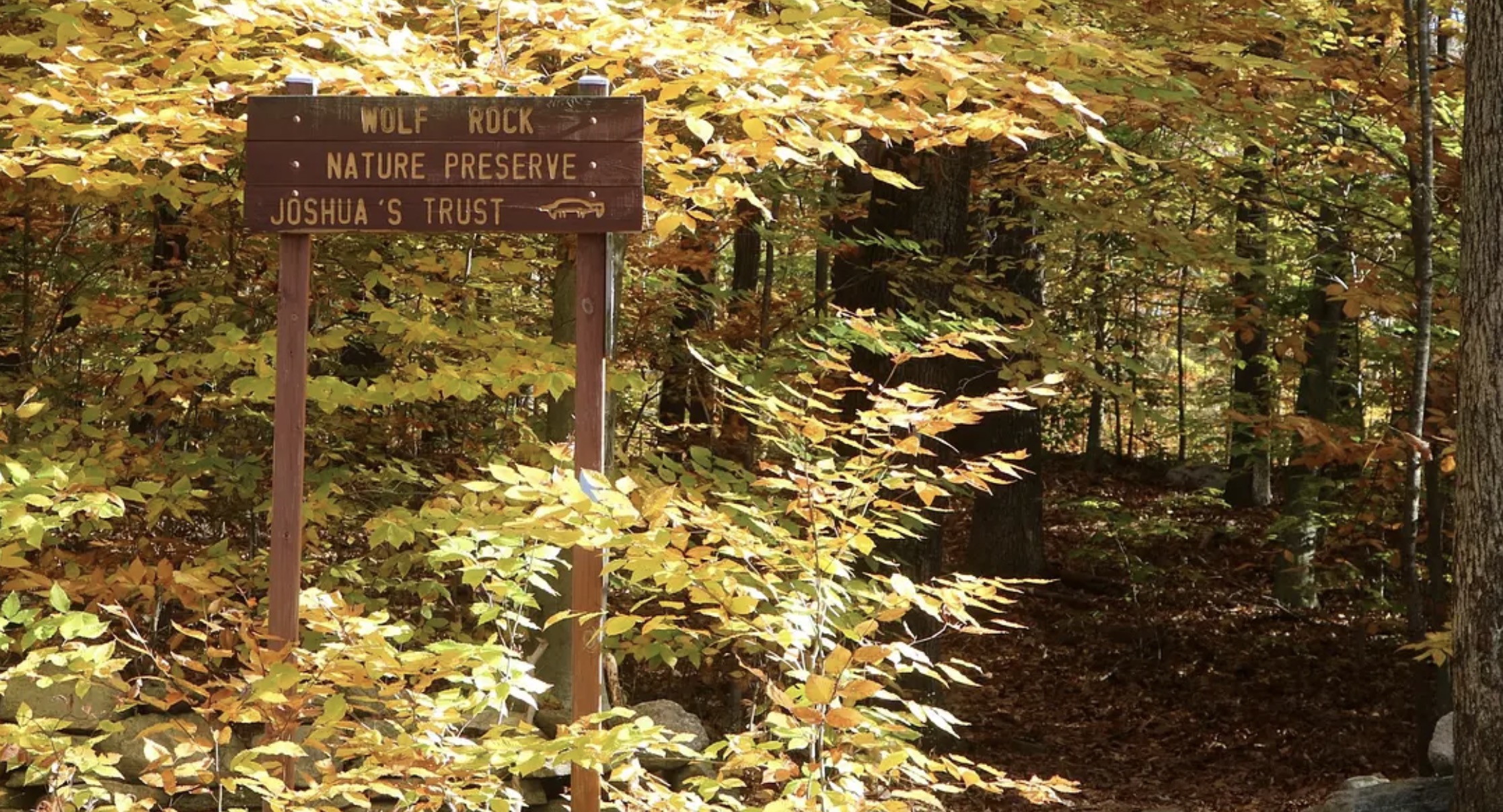
Wolf Rock Nature Preserve, Mansfield, Connecticut:
Located a few miles north of Eastern Connecticut State University is Mansfield’s natural wonder, Wolf Rock Nature Preserve. It’s comprised of 108 acres of forest, trails and a great boulder called Wolf Rock. The preserve is as Joshua’s Tract Conservation and Historic Trust or Joshua’s Trust for short. Joshua’s Trust was named after a Mohegan leader who sold large swaths of land to English settlers in the 1676.
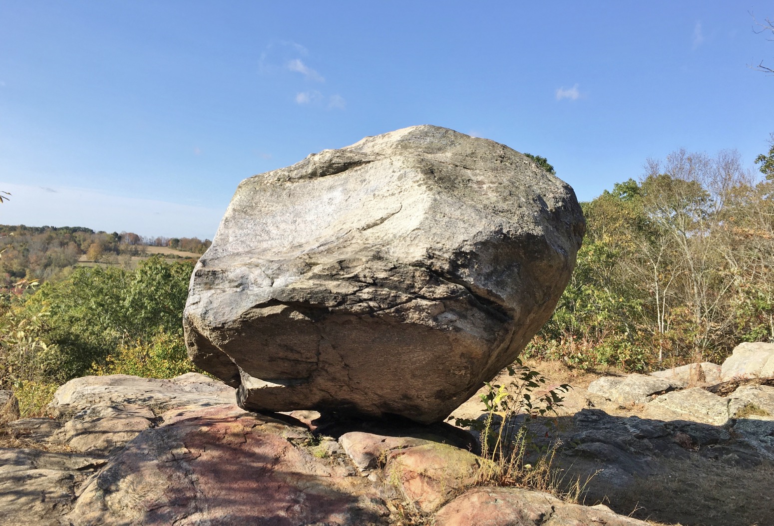
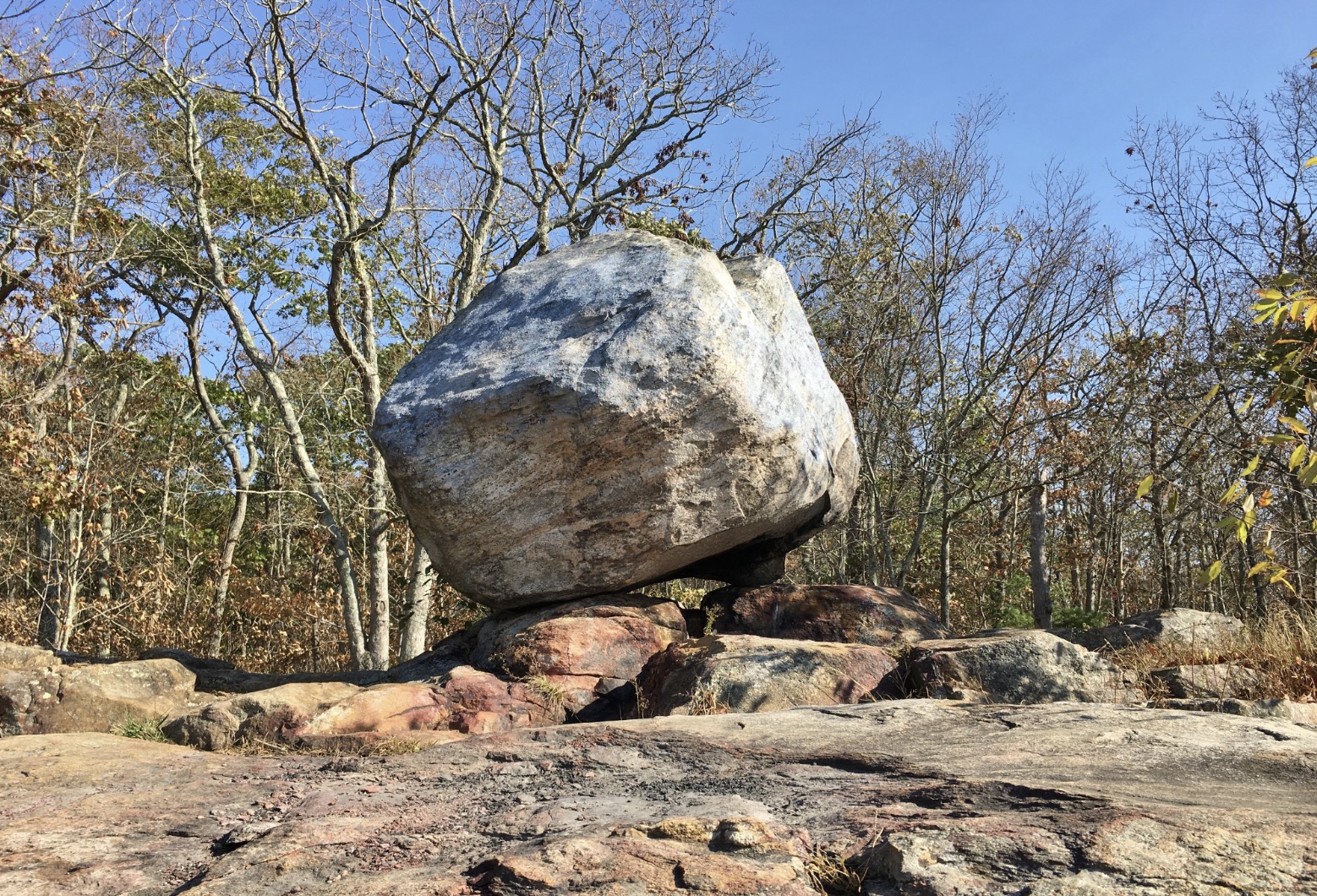
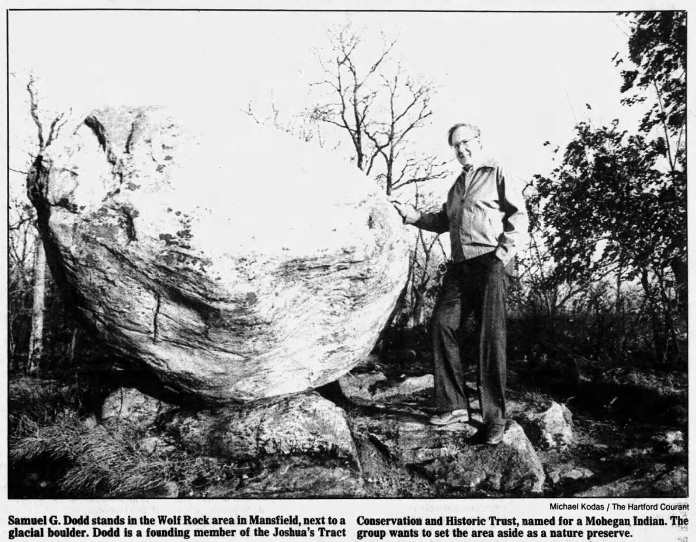
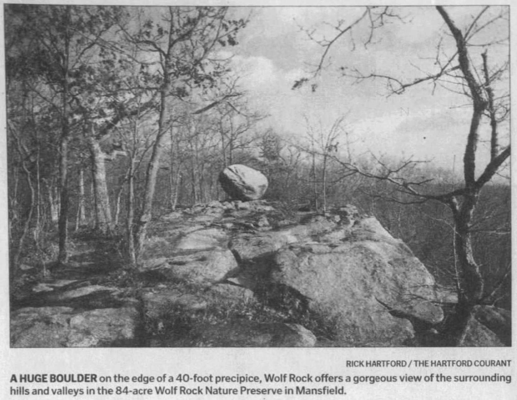
The trust was founded nearly three centuries later in 1966 by local conservationists who wanted to protect the area and its history from real estate development. The group was led in part by a retired doctor named Samuel G. Dodd of Mansfield.The highlight of the preserve is a geological formation known as Wolf Rock – also known as Wolfpit Rocks, or Wolfe’s Rock. The boulder, classified as a glacial erratic, is perched atop a forty foot cliff that’s popular with mountain climbers.
Wolf Rock is six feet tall, oblong, and made mostly of gneiss and quartz. It was once used as part of a tower for surveying the landscape. The tower is now gone, but remnants of the tower are visible. Joshua’s Trust also includes part of the Nipmuck Trail, a popular hike that extends 37-miles from Union, Connecticut to Mansfield Hollow State Park.
According to the official website of Joshua’s Trust:
Wolf Rock is mentioned as far back as the eighteenth century and was included in various deeds. It was named for the wolves which once lived here, and thus is often incorrectly associated with Israel Putnam. Some historians speculate that have referred to a person with a similar last name. Though the rock is situated on a 40-foot part of the ledge, the ledge itself goes up to 544 feet and dips down to 25 feet in some places. There is a cairn located nearby.
The ledge and the boulder have both together and separately been called Wolf Rock since earliest times. The “great rock on the height of the ledge” is mentioned in deeds as early as the late 18th century, and the view is almost as celebrated. Looking southeast from the top of the ledge you can see the Sawmill Brook valley below, and fields on Crane Hill Road.
The blue-blazed Nipmuck Trail crosses Crane Hill Road at the property entrance and continues through it and down past Sawmill Brook.
This preserve has been pieced together over the decades thanks to several generous donors and public funds. The Town of Mansfield’s Sawmill Brook property connects to the Wolf Rock Preserve, and the properties are managed jointly. The last adjacent parcel donated to the Trust was the Bailey property, 12-plus forested acres contiguous with the south-west side of wolf Rock and bordered by the old Blacksmith Shop Road.
Location: Mansfield Center, Connecticut. Property lies between Crane Hill Road and Puddin’ Lane.
Donors: This parcel would not have been preserved without many supporters and contributers, including Dorothy Goodwin, Florence A. Palmer, Dan Costello, Ann Cerreto-Costello, James and Pat Leta, George and Ann Bailey.
Acres: 108.3 acres
Preserved: 1971, 1977, 1980, 1989, 1990, 1999 and 2007
Stewards: John Hankins and Greg PadickFrom joshuastrust.org