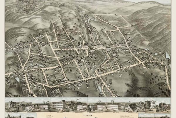
Collinsville, Connecticut:
In 1826, a group led by Samuel Watkinson Collins and his brother David, purchased a sawmill and gristmill property along the Farmington River in South Canton. They began mass-producing high-quality axes as The Collins Company. The company produced 1,300 types of axes, pickaxes and other cutting tools, which were used during in significant periods of history such as, the California Gold Rush, construction of the Trans-Siberian Railroad, and the exploration of the North Pole by Admiral Peary in 1909. The U.S. Military also purchased millions of Collins tools for soldiers during WWI and WWII and subsequent wars.
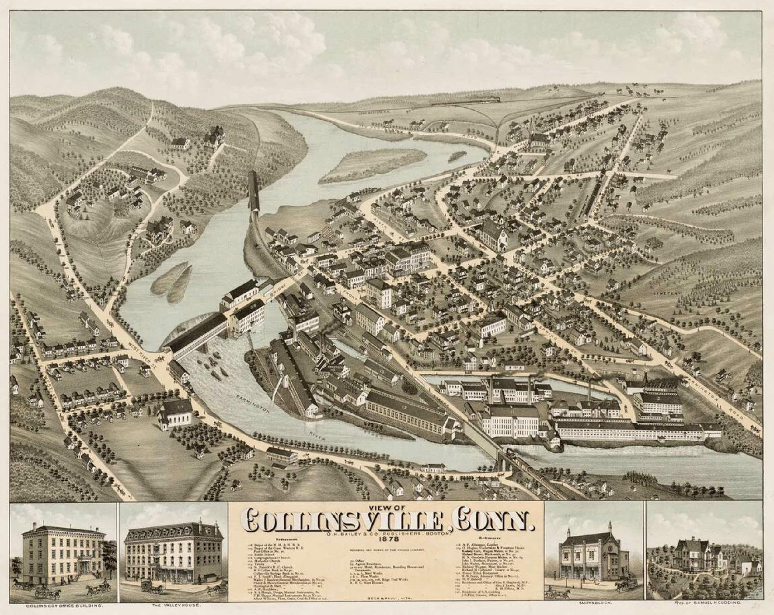
As the business and number of factory laborers grew, the Collins brothers built housing, a Congregational church, bank, and other structures to support workers and their families – this section of Canton became known as Collinsville. The former railroad line, which Sam Collins brought to Town and through the middle of the factory in 1850, has today been converted to the Farmington Valley Greenway Rail Trail for recreational use. The 1935 Collins hydro powerhouse on the River, is currently being rebuilt to supply water-powered electricity back to the grid. The central portion of the village is a historic district listed on the National Register of Historic Places in 1976.